Beach
Güigüi
 La Aldea de San Nicolás, Spain · sea 23.4 °C at its warmest, in September

Sea temperature month by month
Monthly means in °C, NOAA OISST v2.1 climatology 1991–2020.
About
Güigüí, Güi-Güi o Guguy es un macizo montañoso del sector costero del centro-oeste de la isla de Gran Canaria (Canarias, España).
Questions
How warm is the sea at Güigüi?
The sea off Güigüi averages 23.4 °C at its warmest, in September, and 18.9 °C at its coolest. These are monthly means from NOAA's OISST v2.1 satellite and buoy record for 1991 to 2020, sampled at the beach's own coordinates.
When can you swim at Güigüi?
The sea reaches 20 °C or more from May to December. Twenty degrees is where most swimmers stop calling water cold; below it, a wetsuit helps.
Where is Güigüi?
Güigüi is on the coast of La Aldea de San Nicolás, Spain, at 27.9467, -15.8277. The map on this site flies straight to it.
Beaches nearby
 MelonerasSan Bartolomé de Tirajana, Spain
 Playa del InglésSan Bartolomé de Tirajana, Spain
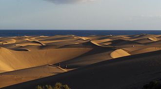 Maspalomas DunesSan Bartolomé de Tirajana, Spain
 San AgustínSan Bartolomé de Tirajana, Spain
 Pozo IzquierdoSanta Lucía de Tirajana, Spain
 Playa de La LajaLas Palmas de Gran Canaria, Spain
 El BurreroIngenio, Spain
 Playa de ArinagaAgüimes, Spain