Beach
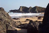
Playa de La Isla
 Colunga, Spain · sea 21.1 °C at its warmest, in August

Sea temperature month by month
Monthly means in °C, NOAA OISST v2.1 climatology 1991–2020, sampled 18 km offshore, at the nearest open water cell of a 0.25° grid.
About
Playa de la Isla está situada en el concejo de Colunga, en el Principado de Asturias (España).
Questions
How warm is the sea at Playa de La Isla?
The sea off Playa de La Isla averages 21.1 °C at its warmest, in August, and 12.6 °C at its coolest. These are monthly means from NOAA's OISST v2.1 satellite and buoy record for 1991 to 2020, sampled at the beach's own coordinates.
When can you swim at Playa de La Isla?
The sea reaches 20 °C or more from August to September. Twenty degrees is where most swimmers stop calling water cold; below it, a wetsuit helps.
Where is Playa de La Isla?
Playa de La Isla is on the coast of Colunga, Spain, at 43.4796, -5.2253. The map on this site flies straight to it.
Beaches nearby
 Playa de El BarrigónColunga, Spain
 Playa de La EspasaCaravia La Baxa, Spain
 Playa de La GriegaColunga, Spain
 Arenal de Morís BeachCaravia L'Alta, Spain
 Playa de LastresLastres, Spain
 Playas de Berbes, Vega y La SierraRibadesella, Spain
 Beach of Santa Marina, RibeseyaRibeseya, Spain
 Playa de MisiegoSeloriu, Spain