Beaches in United Kingdom
 200 beaches on the atlas, 200 of them with a measured sea temperature. Open United Kingdom on the map →
Warmest sea
| Beach | Warmest month | °C | 20 °C or more |
|---|---|---|---|
| Seven Mile Beach | August | 29.7 | All year |
| Rum Point Beach | August | 29.7 | All year |
| The Baths | September | 28.9 | All year |
| Horseshoe Bay | August | 27.9 | January, May, June, July, August, September, October, November and December |
| Sinky Bay | August | 27.9 | January, April, May, June, July, August, September, October, November and December |
| Marley Beach | August | 27.9 | January, May, June, July, August, September, October, November and December |
| Lady's Mile Beach | August | 27.1 | May to November |
| Eastern Beach | August | 21.6 | July to September |
| Camp Bay, Gibraltar | August | 21.6 | July to September |
| Felixstowe Beach | August | 18.4 | never |
| Kilve Beach | August | 18.2 | never |
| Dunwich Beach | August | 18.2 | never |
| Cold Knap | August | 18 | never |
| Sandwich and Pegwell Bay | August | 17.9 | never |
| Ventnor beach | August | 17.8 | never |
| Langland Bay | August | 17.7 | never |
| Aberavon Beach | August | 17.7 | never |
| Rotherslade | August | 17.7 | never |
| East Beach | August | 17.7 | never |
| Bracelet Bay Beach | August | 17.7 | never |
| Alum Bay Beach | August | 17.7 | never |
| Covehithe Beach | August | 17.7 | never |
| Climping Beach | August | 17.5 | never |
| Studland Beach | August | 17.5 | never |
| Bournemouth Beach | August | 17.5 | never |
All 200 beaches
 Chesil BeachDorset, United Kingdom
 Camber SandsEngland, United Kingdom
 Pendine SandsCarmarthenshire, United Kingdom
 Seven Mile BeachGrand Cayman, United Kingdom
 The BathsBritish Virgin Islands, United Kingdom
 Freshwater WestAngle, United Kingdom
 Crosby BeachCrosby, United Kingdom
 Barafundle BayPembrokeshire, United Kingdom
 Saunton SandsSaunton, United Kingdom
 Horseshoe BayBermuda, United Kingdom
 Marloes SandsPembrokeshire, United Kingdom
 Bedruthan StepsCornwall, United Kingdom
 Fistral BeachCornwall, United Kingdom
 Whitesands BayPembrokeshire, United Kingdom
 Weymouth BeachWeymouth, United Kingdom
 Horsey BeachUnited Kingdom
 Langland BaySwansea, United Kingdom
 Aberdeen Beach and Queens LinksAberdeen City, United Kingdom
 Blackpool SandsStoke Fleming, United Kingdom
 Aberavon BeachNeath Port Talbot, United Kingdom
 Cefn SidanPembrey and Burry Port Town, United Kingdom
 Church Ope CovePortland, United Kingdom
 Lusty GlazeNewquay, United Kingdom
 The StadeUnited Kingdom
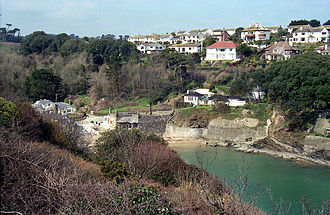 Readymoney CoveFowey, United Kingdom
 Llanddwyn BeachIsle of Anglesey, United Kingdom
 Downhill StrandUnited Kingdom
 Eastern BeachGibraltar, United Kingdom
 Pedn VounderSt Levan, United Kingdom
 Seton SandsEast Lothian, United Kingdom
 Monmouth BeachLyme Regis, United Kingdom
 Kennack SandsGrade-Ruan, United Kingdom
 Gyllyngvase BeachFalmouth, United Kingdom
 Traeth LafanGwynedd, United Kingdom
 Whiteford SandsUnited Kingdom
 Oddicombe BeachTorbay, United Kingdom
 Goodrington SandsTorbay, United Kingdom
 Portstewart StrandUnited Kingdom
 Climping BeachUnited Kingdom
 Elberry CoveTorbay, United Kingdom
 Traeth BychanUnited Kingdom
 Tràigh MhòrOuter Hebrides, United Kingdom
 Broad Haven SouthStackpole and Castlemartin, United Kingdom
 Longniddry BentsEast Lothian, United Kingdom
 St. Mary's BayUnited Kingdom
 Tunnels BeachesIlfracombe, United Kingdom
 Ffrith BeachUnited Kingdom
 Vault BeachSt Goran, United Kingdom
 Castle CoveWeymouth, United Kingdom
 Sandymouth BeachKilkhampton, United Kingdom
 Marros SandsEglwyscummin, United Kingdom
 Weston MouthUnited Kingdom
 BroadsandsTorbay, United Kingdom
 Porthchapel BeachUnited Kingdom
 Broadsands BeachBerrynarbor, United Kingdom
 Dail MòrOuter Hebrides, United Kingdom
 AbermawrPembrokeshire, United Kingdom
 Balcreuchan PortUnited Kingdom
 RothersladeSwansea, United Kingdom
 Watergate BeachMawgan-in-Pydar, United Kingdom
 WallogUnited Kingdom
 Sands of EvieOrkney Islands, United Kingdom
 Lang AyreShetland Islands, United Kingdom
 Sinky BayBermuda, United Kingdom
 Little BeachPortland, United Kingdom
 Shoreham BeachUnited Kingdom
 Porth CeiriadLlanengan, United Kingdom
 Marley BeachWarwick Parish, United Kingdom
 Sandwich and Pegwell BayUnited Kingdom
 Hamworthy BeachUnited Kingdom
 Camp Bay, GibraltarGibraltar, United Kingdom
 Horton BeachUnited Kingdom
 Hemmick BeachUnited Kingdom
 Fishcombe CoveTorbay, United Kingdom
 Veor CoveZennor, United Kingdom
 Prince’s BeachOuter Hebrides, United Kingdom
 Treen CoveZennor, United Kingdom
 East BeachSelsey, United Kingdom
 Holkham BeachUnited Kingdom
 CwmtyduCeredigion, United Kingdom
 Blackpool SandsBlackpool, United Kingdom
 Paul BeachSouth Georgia and the South Sandwich Islands, United Kingdom
 Traeth BenllechUnited Kingdom
 Porth IagoGwynedd, United Kingdom
 Porth Tŷ MawrGwynedd, United Kingdom
 Penllech BeachTudweiliog, United Kingdom
 Traeth DynionAmlwch Community, United Kingdom
 Traeth RhosneigrUnited Kingdom
 Thurstaston BeachWirral, United Kingdom
 Towyn BeachGwynedd, United Kingdom
 Porth TrecastellIsle of Anglesey, United Kingdom
 Porth YchainGwynedd, United Kingdom
 Traeth LligwyMoelfre, United Kingdom
 Scarasta beachOuter Hebrides, United Kingdom
 Newry BeachHolyhead, United Kingdom
 Criccieth BeachGwynedd, United Kingdom
 Traeth LlydanLlanfaelog, United Kingdom
 Aberffraw SandsAnglesey, United Kingdom
 Traeth MoelfreUnited Kingdom
 Formby BeachFormby, United Kingdom
 Traeth Bae TrearddurUnited Kingdom
 Traeth BiwmaresUnited Kingdom
 Porthmeor BeachUnited Kingdom
 Porthgwidden BeachUnited Kingdom
 Porthminster BeachUnited Kingdom
 Slapton SandsSouth Hams, United Kingdom
 Lydstep Haven BeachPembrokeshire, United Kingdom
 Studland BeachStudland, United Kingdom
 Lannacombe BeachUnited Kingdom
 Bantham BeachThurlestone, United Kingdom
 Porthcurno BeachSt Levan, United Kingdom
 Caerfai BeachSt David's and the Cathedral Close, United Kingdom
 Porthcressa BeachIsles of Scilly, United Kingdom
 Bar PointIsles of Scilly, United Kingdom
 Amroth BeachAmroth, United Kingdom
 North BeachPembrokeshire, United Kingdom
 Tenby Castle BeachPembrokeshire, United Kingdom
 South BeachPembrokeshire, United Kingdom
 West Angle BayPembrokeshire, United Kingdom
 Newgale BeachPembrokeshire, United Kingdom
- Borth Beach
- Bennar Beach
- Littlehaven Beach
- Perranuthnoe Beach
- Portreath Beach
- Praa Sands
- Great Perhaver
- Par Beach
- Porthcothan beach
- Wonwell Beach
- Felixstowe Beach
- Arlo Porth
- Sennen Beach
- Summerleaze Beach, Bude
- Polzeath Beach
- Porthbeor Beach
- Towan Beach
- Great Molunan Beach
- Lady's Mile Beach
- Ayre of Cara
- Denge Beach
- Gullane Sands
- Rum Point Beach
- Porthgwarra Beach
- Charmouth Beach
- Man O'War Beach
- Babbacombe Beach
- Gara Rock beach
- South Milton Sands
- Lansallos Beach
- Chapel Porth Beach
- Perranporth Beach
- Kilve Beach
- Manorbier Beach
- Tresaith Beach
- Llangrannog Beach
- Roanhead Beach
- Watcombe Beach
- Maidencombe Beach
- Bournemouth Beach
- Cleadale Beach
- Ventnor beach
- Vestey's beach
- Machrihanish Beach
- Llanddona Beach
- Cold Knap
- Bracelet Bay Beach
- Rhossili Beach
- Pembrey Beach
- Wiseman's Bridge beach
- Coppet Hall Beach
- Saundersfoot Beach
- Penally Beach
- Freshwater East Beach
- Newport Sands
- Poppit Sands
- Penbryn Beach
- North Beach
- Harlech Beach
- Glan Don Beach
- Rhyl East
- Prestatyn Beach
- Ferryside Beach
- Widemouth Sands
- Luskentyre beach
- Alum Bay Beach
- Portholland Beach
- Mothecombe Beach
- Wildersmouth Beach
- Duckpool Beach
- Speeton Sands
- Dunwich Beach
- Covehithe Beach
- Porth Cwyfan
- Preston Sands
- Scabbacombe Sands
- Mattiscombe Sands
- Long Sands
- Llanbedrog beach
- Man Sands
Questions
How many beaches are on the map in United Kingdom?
200, a curated selection drawn from Wikidata rather than a complete register of every beach in United Kingdom. Each one has coordinates and a photograph, and 102 of them have a Wikipedia article.
Where is the sea warmest in United Kingdom?
Of the beaches mapped here, Seven Mile Beach has the warmest water: 29.7 °C in August, from NOAA's 1991 to 2020 climatology.