Beaches in United States
 370 beaches on the atlas, 359 of them with a measured sea temperature. Open United States on the map →
Warmest sea
| Beach | Warmest month | °C | 20 °C or more |
|---|---|---|---|
| Siesta Beach | August | 30.1 | March to December |
| Stump Pass Beach State Park | August | 30.1 | March to December |
| Smathers Beach | August | 30 | All year |
| El Jardin Beach | August | 30 | April to November |
| Anne's Beach | August | 29.9 | All year |
| Bonita Beach | August | 29.8 | April to November |
| Crandon Park | August | 29.7 | All year |
| Mid-Beach | August | 29.7 | All year |
| John U. Lloyd Beach State Park | August | 29.7 | All year |
| Hillsboro Beach | August | 29.7 | All year |
| John D. MacArthur Beach State Park | August | 29.5 | All year |
| Asan Invasion Beach | July | 29.4 | All year |
| Cetti Bay | July | 29.4 | All year |
| Agat Invasion Beach | July | 29.4 | All year |
| Tanguisson Beach | July | 29.4 | All year |
| Ritidian Beach | July | 29.4 | All year |
| Ypao Beach | July | 29.4 | All year |
| Gabgab Beach | July | 29.4 | All year |
| Trinchera Beach | July | 29.4 | All year |
| Grayton Beach State Park | August | 29.3 | April to November |
| Henderson Beach State Park | August | 29.3 | April to December |
| Playa Buyé | September | 29.2 | All year |
| El Tuque | September | 29.1 | All year |
| Lucía Beach | September | 29.1 | All year |
| Domes Beach | September | 29.1 | All year |
All 370 beaches
 Coney IslandBrooklyn, United States
 WaikikiHonolulu, United States
 Cannon BeachClatsop County, United States
 Glass BeachCalifornia, United States
 Black's BeachSan Diego County, United States
 Baker BeachSan Francisco, United States
 Grand StrandSouth Carolina, United States
 Martin's BeachSan Mateo County, United States
 Zuma BeachMalibu, United States
 Jacob Riis ParkQueens, United States
 Punalu'u BeachHawaii, United States
 Ocean BeachSan Francisco, United States
 Venice BeachLos Angeles, United States
 Lanikai BeachKailua, United States
 Papakolea BeachHawaii, United States
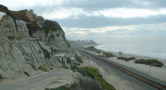 San Onofre State BeachSan Diego County, United States
 Orchard BeachThe Bronx, United States
 Revere BeachRevere, United States
 Santa Monica State BeachSanta Monica, United States
 Will Rogers State BeachLos Angeles, United States
 Flamenco BeachCulebra, United States
 Siesta BeachSiesta Key, United States
 Hanakapiai BeachKauai County, United States
 Ruby BeachJefferson County, United States
 La Push BeachWashington, United States
 Nantasket BeachPlymouth County, United States
 Playalinda BeachFlorida, United States
 Gibney BeachUnited States Virgin Islands, United States
 Natural Bridges State BeachSanta Cruz County, United States
 Doheny State BeachDana Point, United States
 Goat Rock BeachCalifornia, United States
 Sunset BeachHonolulu County, United States
 Crash Boat BeachAguadilla, United States
 Pfeiffer BeachMonterey County, United States
 Rockaway BeachQueens, United States
 Oak Street BeachChicago, United States
 Windansea BeachSan Diego County, United States
 Waikoloa BeachPuakō, United States
 Children's Pool BeachSan Diego County, United States
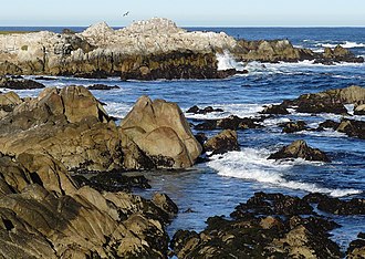 Asilomar State BeachMonterey County, United States
 Sandy Beach, HawaiiHawaii, United States
 Collins BeachOregon, United States
 Alki Beach ParkSeattle, United States
 Crane BeachMassachusetts, United States
 RAT BeachUnited States
 Rincon Beach County ParkSanta Barbara County, United States
 Dockweiler State BeachLos Angeles, United States
 Bowling Ball BeachMendocino County, United States
 Bolsa Chica State BeachOrange County, United States
 Grayton Beach State ParkFlorida, United States
 Point Dume State BeachLos Angeles County, United States
 Golden Gardens ParkSeattle, United States
 Adeline Jay Geo-Karis Illinois Beach State ParkLake County, United States
 Hammonasset Beach State ParkNew Haven County, United States
 Crandon ParkMiami, United States
 Rialto BeachClallam County, United States
 China Beach, San FranciscoSan Francisco County, United States
 Rodeo BeachMarin County, United States
 Cabrillo BeachLos Angeles, United States
 Condado BeachSan Juan, United States
 Montara State BeachCalifornia, United States
 Torrey Pines State BeachSan Diego, United States
 Wai'anapanapa State ParkMaui County, United States
 Chicken Bone BeachUnited States
 Higgins BeachMaine, United States
 Corona del Mar State BeachCalifornia, United States
 Nauset BeachBarnstable County, United States
 John D. MacArthur Beach State ParkFlorida, United States
 Carson Beach, South BostonMassachusetts, United States
 Malibu Lagoon State BeachLos Angeles County, United States
 El Capitán State BeachSanta Barbara County, United States
 Seacliff State BeachCalifornia, United States
 Cedar Lake East BeachMinneapolis, United States
 Centennial BeachIllinois, United States
 Kathryn Abbey Hanna ParkUnited States
 Duxbury BeachUnited States
 Half Moon Bay State BeachSan Mateo County, United States
 Carlsbad State BeachCarlsbad, United States
 Misquamicut State BeachWashington County, United States
 Wingaersheek BeachUnited States
 Popham BeachSagadahoc County, United States
 Shell BeachSan Diego, United States
 Glass BeachKauai County, United States
 Moonlight BeachCalifornia, United States
 Kauapea BeachKauai County, United States
 Salt Creek Beach ParkDana Point, United States
 Poverty BeachNew Jersey, United States
 Kehena BeachPuna, United States
 Shelter Cove, Pacifica, CaliforniaCalifornia, United States
 Pismo State BeachCalifornia, United States
 Cedar BeachMount Sinai, United States
 Arroyo Burro BeachCalifornia, United States
 Hapuna Beach State Recreation AreaHawaii County, United States
 Mid-BeachMiami Beach, United States
 Pacifica State BeachSan Mateo County, United States
 Poipu Beach ParkPoipu, United States
 New Brighton State BeachSanta Cruz County, United States
 John U. Lloyd Beach State ParkFlorida, United States
 Gray Whale Cove State BeachCalifornia, United States
 Nahant Beach ReservationMassachusetts, United States
 Marina State BeachMonterey County, United States
 Refugio State BeachSanta Barbara County, United States
 Anne's BeachMonroe County, United States
 Boneyard BeachFlorida, United States
 Cahoon Hollow BeachMassachusetts, United States
 Sand Dollar BeachMonterey County, United States
 Greenwich PointUnited States
 Manresa State BeachSanta Cruz County, United States
 Bean Hollow State BeachSan Mateo County, United States
 Jobos BeachPuerto Rico, United States
 Constitution BeachMassachusetts, United States
 Isaac Hale Beach ParkPuna, United States
 Emma Wood State BeachVentura, United States
 Henderson Beach State ParkFlorida, United States
 San Clemente State BeachSan Clemente, United States
 Winthrop BeachMassachusetts, United States
 Barker BeachSan Francisco, United States
 San Gregorio State BeachSan Mateo County, United States
 Topanga State BeachLos Angeles County, United States
 Huntington State BeachOrange County, United States
- El Tuque
- Beverly Beach State Park
- Carpinteria State Beach
- Jalama Beach County Park
- Goleta Beach
- Morro Strand State Beach
- Lucía Beach
- Carmel River State Beach
- El Porto Beach
- Scusset Beach State Reservation
- Pescadero State Beach
- Ocean Park Beach
- San Elijo State Beach
- Stump Pass Beach State Park
- Blue Beach
- Mar Bella Beach
- Smathers Beach
- Poplar Beach
- Calf Pasture Beach
- Domes Beach
- William Randolph Hearst Memorial Beach
- Coki Beach
- Robert H. Meyer Memorial State Beach
- Short Beach
- Salisbury Beach State Reservation
- West Beach, Beverly, Massachusetts
- Crown Memorial State Beach
- Lighthouse Field State Beach
- Craigville Beach
- Cayucos State Beach
- Bradford Beach
- Coquina Beach
- McGrath State Beach
- Marine Street Beach
- Anini Beach
- Lumahai Beach
- Playa Buyé
- North Hempstead Beach Park
- East Beach
- Mākaha Beach Park
- Scarborough Beach
- South Carlsbad State Beach
- Wallis Sands State Park
- Point Sal State Beach
- Albany Beach
- Roger Wheeler State Beach
- San Buenaventura State Beach
- Trinidad State Beach
- Ohio Street Beach
- Moolack Beach
- Doran Regional Park
- New Silver Beach
- Thornton State Beach
- Cardiff State Beach
- Richardson Beach
- Hampton Beach State Park
- Gooseberry Beach
- Twin Lakes State Beach
- Asan Invasion Beach
- Sunset State Beach
- Leadbetter Beach
- Walnut Beach
- Caracas Beach
- Pomponio State Beach
- Moss Landing State Beach
- Poet's Beach
- Caspar Headlands State Beach
- James Kealoha Beach
- Double Bluff Beach
- Arcadia Beach State Recreation Site
- Monterey State Beach
- Slaughterhouse Beach
- Schooner Gulch State Beach
- Agate Beach State Recreation Site
- Jenness State Beach
- Bullards Beach State Park
- Rye Town Park-Bathing Complex and Oakland Beach
- Grayland Beach State Park
- D.T. Fleming Beach
- Salty Brine State Beach
- Mandalay State Beach
- Lakeview Park
- East Matunuck State Beach
- Greenwood State Beach
- Salinas River State Beach
- Yirrell Beach
- Oceanside Beach State Recreation Site
- Driftwood Beach State Recreation Site
- Little River State Beach
- Westport–Union Landing State Beach
- Leucadia State Beach
- McCook Point Park
- Cetti Bay
- Manhattan Beach State Recreation Site
- Agat Invasion Beach
- West Beach
- Lone Ranch Beach
- Gleneden Beach State Recreation Site
- Aliso Beach
- Del Rey Beach State Recreation Site
- Audrey McCall Beach
- Hideaway Beach, Princeville, North Shore, Kauai
- La Pocita de las Golondrinas Beach
- Bricktown Beach
- Bethel Beach Natural Area Preserve
- Pioneer Square Habitat Beach
- North Hampton State Beach
- Ophir Beach
- Lake City Beach Park
- Barrington Beach
- Pico Piedra
- White Crest Beach
- Attaquin Beach
- Malaquite Beach
- Tanguisson Beach
- South Beach
- Ritidian Beach
- Ypao Beach
- Gabgab Beach
- Trinchera Beach
- Compo Beach
- Balneario Luquillo
- Agate Beach
- Arched Rock Beach
- Bastendorff Beach
- Boomer Beach
- Cowell Beach
- Encinal Beach
- Fan Shell Beach
- Huntington City Beach
- Little Corona Del Mar Beach
- Makapuʻu Beach
- Puʻunoa
- Santa Cruz Beach
- Sharp Park Beach
- Wipeout Beach
- Boca Chica State Park
- Keller Beach
- Sullivan's Island Beach
- Beach 1
- McAbee Beach
- Redwood Creek Beach
- Lovers Point Beach
- Shark Fin Cove (California)
- Noyo Harbor Beach
- Beach 2
- Beach 4
- South Beach
- Paako Beach
- Kahekili Beach
- Nevada Beach
- South Casa Beach
- Kincaid Beach
- Treasure Island Beach
- Kamaole III Beach
- Gibson Beach
- El Jardin Beach
- Babbs Beach
- Esker Point Beach
- Southport Beach
- Haulover Beach
- Hawknest Beach
- Little Cinnamon Bay Beach
- Magens Bay Beach
- Mandahl Bay Beach
- Salomon Beach
- Trunk Beach
- Beulah Beach
- Elberta Beach
- Goochs Beach
- Ottawa Beach
- Sand Beach
- South Beach
- Western Beach
- Isabella Beach
- Bethany Beach
- Ocean Park Beach
- Bernies Beach
- Bonita Beach
- Bonny Doon Beach
- Carmel Beach
- Cresent Beach
- Culebrita Beach
- Del Mar Beach
- Dunes Beach
- Elmar Beach
- Francis Beach
- Grays Beach
- Hendrys Beach
- Hillsboro Beach
- Hobuck Beach
- Kahanamoku Beach
- Kamaʻole
- Kirby Beach
- Kiwanda Beach
- La Jolla Shores Beach
- Laguna Point Beach
- Luis Peña Beach
- Maluaka Beach
- Manhattan Beach
- Mateo Coast State Beaches
- Mattole Beach
- Montara Beach
- Moonstone Beach
- Mōkapu Beach
- North Moss Beach
- Nye Beach
- Olbrich Beach
- Palauea Beach
- Palisades Beach
- Panther Beach
- Pettibone Beach
- Playa Media Luna
- Playa Sun Bay
- Polo Beach
- Poʻolenalena Beach
- Pāpōhaku Beach
- Redondo Beach
- Rockaway Beach
- Royal-Moana Beach
- Sagamore Beach
- San Carlos Beach
- San Pedro Beach
- Sand Beach
- Seabright Beach
- Seaside Creek Beach
- Second Beach
- Shipwreck Beach
- Singing Beach
- South Beach
- Sunset Beach
- Tenney Beach
- Torrance County Beach
- Tunitas Beach
- Venice Beach
- Waddell Creek Beach
- Wages Creek Beach
- Wailea Beach
- Wallops Beach
- Yellow Banks
- El Matador State Beach
- Grays Beach
- 49 Black Sand Beach
- Sandbridge Beach
- Salt Ponds Beach
- Marshall's Beach
- Honokalani Black Sand Beach
- Playa Tamarindo
- Hallett's Cove Beach
- Middle Beach
Questions
How many beaches are on the map in United States?
370, a curated selection drawn from Wikidata rather than a complete register of every beach in United States. Each one has coordinates and a photograph, and 240 of them have a Wikipedia article.
Where is the sea warmest in United States?
Of the beaches mapped here, Siesta Beach has the warmest water: 30.1 °C in August, from NOAA's 1991 to 2020 climatology.